Minnesota · Otter Tail County
Crystal Lake Fishing guide
Crystal Lake sits in Otter Tail County, Minnesota, and covers 1,413 acres, reaching 55 ft at its deepest point. Secchi readings average around 9.5 ft of visibility. The Minnesota DNR has surveyed the lake 12 times, most recently in 2024, with walleye, largemouth bass, smallmouth bass and northern pike in the nets.
DNR survey data
Fish species
WalleyeLast stocked 2024Good numbers4.9per gill net16"Typical26"Biggest
Lengths measured · 46 fish
Recent · 2023 + 2024Lengths measured · 2 fish
2024Only 2 fish measured that year — too few to read as a shape.
Lengths measured · 44 fish
2023Lengths measured · 53 fish
2018Lengths measured · 53 fish
2014Largemouth bassPresent2.3per gill net13"Typical18"Biggest
Lengths measured · 30 fish
Recent · 2023 + 2024Lengths measured · 9 fish
2024Only 9 fish measured that year — too few to read as a shape.
Lengths measured · 21 fish
2023Lengths measured · 40 fish
2018Lengths measured · 1 fish
2014Only 1 fish measured that year — too few to read as a shape.
Northern pikeGood numbers10per gill net20"Typical26"Biggest
Lengths measured · 99 fish
Recent · 2023 + 2024Lengths measured · 9 fish
2024Only 9 fish measured that year — too few to read as a shape.
Lengths measured · 90 fish
2023Lengths measured · 60 fish
2018Lengths measured · 159 fish
2014BluegillJust a few11.4per trap net7"Typical9"Biggest
Lengths measured · 431 fish
Recent · 2022 + 2023 + 2024Lengths measured · 137 fish
2024Lengths measured · 9 fish
2023Only 9 fish measured that year — too few to read as a shape.
Lengths measured · 285 fish
2022Lengths measured · 233 fish
2018Rock bassExcellent numbers2.6per trap net7"Typical10"Biggest
Lengths measured · 32 fish
Recent · 2023 + 2024Lengths measured · 31 fish
2024Lengths measured · 1 fish
2023Only 1 fish measured that year — too few to read as a shape.
Lengths measured · 44 fish
2018Lengths measured · 63 fish
2014Rates come from standard DNR survey gear (gill nets, trap nets, electrofishing), judged against statewide benchmarks for the same gear, so the same number of fish per net can read differently for two species. Where the standard gear can't count a species reliably, only presence and size are listed. Typical is the middle fish of those measured. Open a row for the full length spread, survey by survey.
How to fish Crystal Lake through the year
Walleye
- Spring
- Walleye are shallow, on and just off the spawning flats and the first green weeds.
- Early summer
- Walleye are setting up on the outside weed edge, points and shallow structure.
- Summer
- Walleye are working the weed edge, points and any wind-blown structure. On a lake that drops to 55 ft, check the deep edge of that structure too.
- Fall
- Walleye are packing onto the sharpest breaks and points as the water cools, in big schools with short windows.
Northern pike
- Spring
- Pike are in the shallow bays and along new weed growth.
- Early summer
- Pike are on the outside weed edge and points.
- Summer
- Pike are on the deep weed edge and points near the coolest water they can find. On a lake that drops to 55 ft, check the deep edge of that structure too.
- Fall
- Pike are on the last green weeds and the breaks beside them, feeding heavily as the water drops.
Season patterns for each species. Open the live map for today's wind, light and water temp.
Size history
Biggest fish by survey year
| Survey year | Walleye | Northern pike | Largemouth bass |
|---|---|---|---|
| 2024 | 26" | 23" | 18" |
| 2023 | 21" | 26" | 15" |
| 2018 | 27" | 29" | 17" |
| 2014 | 26" | 30" | 15" |
| 2010 | 28" | 26" | 15" |
| 2006 | 25" | 34" | 18" |
| 2002 | 29" | 25" | 18" |
Longest fish measured by DNR survey crews in each year's nets. Survey gear samples the population, so the lake usually holds larger fish than any survey measured.
Suggested tackle
What to bring
Top presentations for this lake's structure and clarity:
Walleye · Live bait
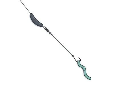
Live-Bait (Lindy) Rig + Leech/Crawler
jumbo leech or half a nightcrawler
Walleye · Trolling
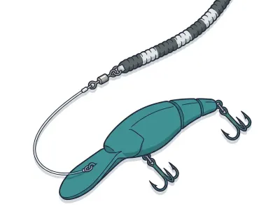
Leadcore Line + Crankbaits
4–5" mid-diving crankbait behind a long leadcore run
Northern pike · Soft plastics
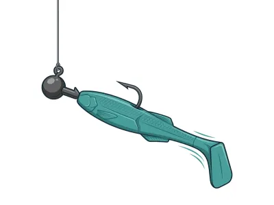
Paddletail Swimbait on Jighead
4–5" paddletail swimbait on a ball-head swimbait jighead
Northern pike · Muskie & pike
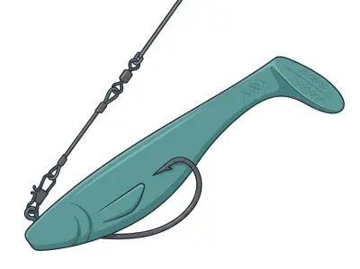
Soft Rubber (Bull Dawg / Medusa)
10" soft rubber body bait
Largemouth bass · Soft plastics
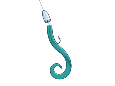
Texas-Rigged Worm
7" ribbon-tail or straight-tail plastic worm
Largemouth bass · Soft plastics
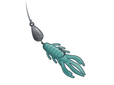
Free Rig
Creature bait or magnum finesse worm
Full setups, including hooks, weights and line, are on the live map. As an Amazon Associate I earn from qualifying purchases.
DNR stocking records
Stocking history
| Year | Species | Stocked |
|---|---|---|
| 2024 | Walleye | 674,000 fry |
| 2022 | Walleye | 674,000 fry |
| 2021 | Walleye | 674,000 fry |
| 2018 | Walleye | 674,000 fry |
| 2016 | Walleye | 674,000 fry |
MN DNR · in their words
From the 2024 survey
A targeted survey of nearshore fish species in Crystal Lake, was conducted over several days, including June 17-18 and June 20, 2024, by Index of Biological Integrity (IBI) Program Staff. Sampling sites were evenly spaced around the lake, and each was sampled by backpack electrofishing and seining with a 50-foot seine, where possible. Backpack electrofishing was completed at all 18 sampling stations, but five stations were sampled from the boat due to site conditions. Similarly, a 50-foot seine was used to sample 12 stations, a 15-foot seine was used to sample two stations, and site conditions prevented the use of seines at four stations. Nearshore sampling captured 20 species of fish including eight species that are intolerant of disturbance (i.e., Banded Killifish, Blackchin Shiner, Blacknose Shiner, Iowa Darter, Least Darter, Pugnose Shiner, Rock Bass, and Smallmouth Bass) and one species that is tolerant of disturbance (i.e., Green Sunfish).
A concurrent summer trap net survey was also conducted by IBI Program Staff. Twelve trap nets were set along the shoreline and in shallow offshore locations that encompassed multiple habitat types. Trap net sampling captured 11 species of fish, including one that is intolerant of disturbance (i.e., Rock Bass) and one that is tolerant of disturbance (i.e., Black Bullhead). Bluegill comprised a majority of the trap net catch by number and Bluegill and Bowfin comprised a majority by biomass.
Read the full DNR narrative
The nearshore and trap net data were combined with gill net data from an August 2023 survey to describe the fish community and provide a Fish-based IBI (FIBI) score. The FIBI uses fish community data to measure a lake's health, and the types of fish species present can help identify any stressors that may be negatively affecting the lake environment. In Minnesota lakes, certain fish species cannot survive without clean water and a healthy habitat (e.g., Blackchin Shiner, Iowa Darter, and Rock Bass), while other species are tolerant of degraded conditions (e.g., Green Sunfish). The FIBI score, composed of several fish community diversity and composition metrics, indicates the overall health of a lake by comparing it to what is expected for a healthy lake. For additional information on the FIBI, search for "lake index of biological integrity" on the mndnr.gov website.
In addition to fish sampling, IBI program staff also conducted an assessment of lakeshore habitat on Crystal Lake on June 18, 2024, following the Score the Shore survey protocols. The assessment consisted of 70 survey sites evenly spaced 200 meters around the lake. Assessments were made in three habitat zones: the shoreline zone (i.e., the shore-water interface to the top of the natural bank), the shoreland zone (i.e., land-ward from shoreline to developed structure or 100 feet), and the aquatic zone (i.e., lake-ward 50 feet from the shoreline). The average lakewide habitat score was 65.2 (+/- 2.9) out of 100 possible. A score of 65.2 indicates the lakewide shoreline condition is poor (i.e., 50-65.9). Approximately 59 percent of the sites were developed, with a mean score of 49.7 (+/- 3.1) indicating shoreline habitat quality of developed sites is very poor (i.e., <50), while undeveloped sites had a mean score of 87.1 (+/- 0.6) with high (i.e., 85-91.9) habitat quality.
Results from this survey provide evidence that the fish community in Crystal Lake is healthy as indicated by an FIBI score above the general use impairment threshold for aquatic life use determined for similar lakes, despite relatively poor lakeshore habitat condition as indicated by the Score the Shore score. The FIBI results are similar to previous findings, which indicated that Crystal Lake is fully supporting aquatic life. The survey results will be considered when the biological health of the lake is assessed during the Otter Tail River Watershed assessment process, which will be completed in coordination with MN Pollution Control Agency. You can help protect the fish community in Crystal Lake by reducing runoff, maintaining natural shorelines, and preventing the spread of invasive species.
Narrative text from the Minnesota DNR lake survey.
Recent reports
Crystal Lake fishing reports
Recent reports on Crystal Lake from guides, tournaments and regular anglers. Anything posted in the last two weeks also bumps the matching spots on the live map, so you'll see a "matches a recent report" tag on them.
Public water access
Getting on the water
- Crystal Lake (trailer launch)
DNR bathymetry
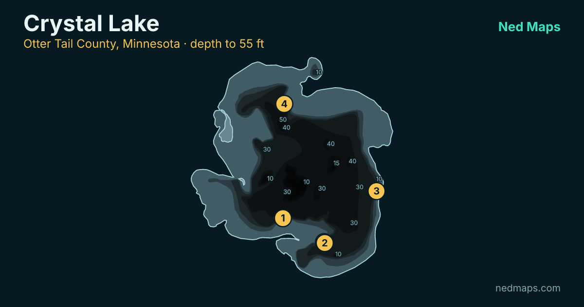
Crystal Lake depth map
Within 30 miles
Nearby lakes
- Franklin Lake · 1,088 ac · 2.2 mi
- Otter Lake · 77 ac · 2.4 mi
- North Lida Lake · 5,523 ac · 2.4 mi
- Lizzie (north portion) Lake · 1,913 ac · 3.4 mi
- East Spirit Lake · 561 ac · 4.4 mi
- Fish Lake · 293 ac · 5.1 mi
- West Silent Lake · 347 ac · 5.5 mi
- South Lida Lake · 777 ac · 5.7 mi
Quick answers
Frequently asked questions
How deep is Crystal Lake?
Crystal Lake reaches 55 ft at its deepest point; about 48% of the lake is littoral (15 ft or shallower).
How big is Crystal Lake?
Crystal Lake covers 1,413 acres with about 8.9 miles of shoreline.
How clear is the water in Crystal Lake?
DNR Secchi readings on Crystal Lake average 9.5 ft of visibility, middling clarity for a Minnesota lake.
What fish are in Crystal Lake?
Minnesota DNR surveys (most recently 2024) record walleye, largemouth bass, smallmouth bass, northern pike, bluegill, crappie, yellow perch, rock bass.
Is Crystal Lake stocked?
Yes. The DNR stocked walleye in 2024; the stocking table on this page lists every year back to 2016.
Does Crystal Lake have a public access?
Yes. Crystal Lake has one public access site: Crystal Lake (trailer launch).
How big do walleye get in Crystal Lake?
The biggest walleye measured in recent DNR surveys taped 26"; the size-history table on this page tracks the biggest fish in each survey back to 2002.
When was Crystal Lake last surveyed?
The Minnesota DNR last surveyed Crystal Lake in 2024, the most recent of 12 surveys on record.
Page updated .

Featured guide spot
Your guide service here
One featured guide per lake, with your photo, your writeup and a link straight to your booking page. Free through December 31, 2026.
Then $20 a month from January. Cancel any time.
The live map adds today's conditions and ranked spots for Crystal Lake, plus a trip plan you can share:
Open Crystal Lake on the live map → Fished it lately? Write a report