Minnesota · Lake County
Wind Lake Fishing guide
Wind Lake sits in Lake County, Minnesota, and covers 926 acres, reaching 32 ft at its deepest point. Secchi readings average around 8 ft of visibility. The Minnesota DNR has surveyed the lake 2 times, most recently in 2011, with walleye, largemouth bass, smallmouth bass and northern pike in the nets. That survey is 15 years old now.
DNR survey data
Fish species
WalleyeGood numbers5.2per gill net17"Typical28"Biggest
Lengths measured · 47 fish
Smallmouth bassPresent1.2per gill net13"Typical19"Biggest
Lengths measured · 11 fish
Northern pikeJust a few3.6per gill net25"Typical33"Biggest
Lengths measured · 32 fish
BluegillPresent2.9per gill net5"Typical8"Biggest
Lengths measured · 26 fish
Rock bassGood numbers3.1per gill net6"Typical8"Biggest
Lengths measured · 28 fish
Rates come from standard DNR survey gear (gill nets, trap nets, electrofishing), judged against statewide benchmarks for the same gear, so the same number of fish per net can read differently for two species. Where the standard gear can't count a species reliably, only presence and size are listed. Typical is the middle fish of those measured. Open a row for the full length spread, survey by survey.
How to fish Wind Lake through the year
Walleye
- Spring
- Walleye are shallow, on and just off the spawning flats and the first green weeds.
- Early summer
- Walleye are setting up on the outside weed edge, points and shallow structure.
- Summer
- Walleye are working the weed edge, points and any wind-blown structure. With 74% of this lake 15 ft or shallower, the weed edge is the main event.
- Fall
- Walleye are packing onto the sharpest breaks and points as the water cools, in big schools with short windows.
Largemouth bass
- Spring
- Largemouth are moving up into the warming bays and flats, staging around wood, docks and new weeds to spawn.
- Early summer
- Largemouth are on the shallow spawning flats and protected bays, where beds go on firm bottom next to isolated cover.
- Summer
- Largemouth are in and along the weeds: cabbage and milfoil edges, matted cover and shade. With 74% of this lake 15 ft or shallower, the weed edge is the main event.
- Fall
- Largemouth are chasing bait back onto the flats and into the remaining green weeds, feeding hard and shallow before the freeze.
Season patterns for each species. Open the live map for today's wind, light and water temp.
Suggested tackle
What to bring
Top presentations for this lake's structure and clarity:
Walleye · Live bait
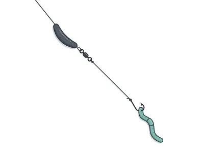
Live-Bait (Lindy) Rig + Leech/Crawler
jumbo leech or half a nightcrawler
Walleye · Trolling
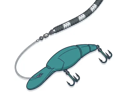
Leadcore Line + Crankbaits
4–5" mid-diving crankbait behind a long leadcore run
Largemouth bass · Soft plastics
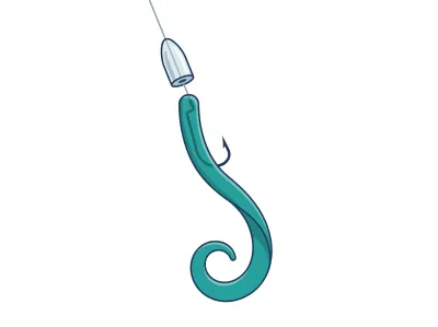
Texas-Rigged Worm
7" ribbon-tail or straight-tail plastic worm
Largemouth bass · Soft plastics
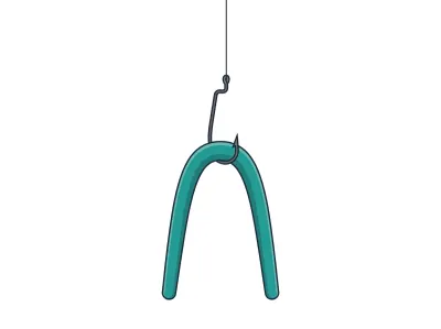
Wacky-Rigged Stickworm
5" stickworm
Smallmouth bass · Soft plastics
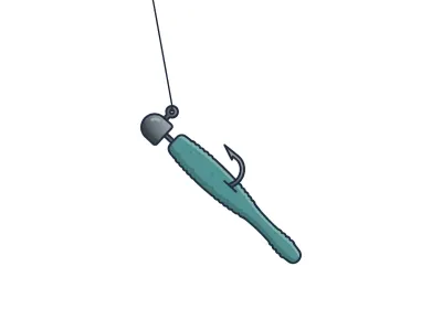
Ned Rig
2.75" finesse stickbait or craw-style Ned bait
Smallmouth bass · Soft plastics
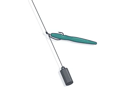
Drop Shot (Finesse Plastic)
4" finesse worm or 3" minnow-profile plastic
Full setups, including hooks, weights and line, are on the live map. As an Amazon Associate I earn from qualifying purchases.
MN DNR · in their words
From the 2011 survey
Status of the Fishery
Wind Lake is located approximately 14 miles NE of Ely, MN and is entirely within the BWCAW. It has a surface area of 1,009 acres and a maximum depth of 32 ft. Wind was thermally stratified on 09/06/2011, the first day of sampling, with a surface temperature of 67.6*F and a bottom temperature of 58.1*F. Water clarity is average.
Read the full DNR narrative
Access is by portage from either Moose Lake on the East end or Basswood Lake on the West. Both portages are approximately 0.5 miles in length. There are several USFS designated campsites around the lake.
Walleye numbers in 2011 (5.2/gill net) were higher than the long term average for all assessments on this lake. Walleye sizes averaged 18.4" and the growth rate was faster than average compared to other lakes in this class. The largest walleye was 28.8".
Northern pike numbers in 2011 (3.5/gill net) were approximately 46 percent of the long term average for all assessments on this lake. Pike sizes averaged 24.7" and the growth rate was slightly faster than average compared to other lakes in this class. The largest pike was 33.1".
Smallmouth bass were sampled for the first time in 2011. Smallmouth numbers (1.2/gill net) were higher than average compared to other lakes in this class. Smallmouth sizes averaged 13.9" and the growth rate was slower than average compared to other lakes in this class. The largest smallmouth was 19.3". Smallmouth bass have not been stocked by DNR Fisheries in this lake.
Bluegill numbers in 2011 (2.9/gill net) were higher than the long term average of 0.17 for all assessments on this lake. Bluegill mean length was 5.4" and the largest bluegill sampled was 8.6".
Other game fish sampled in 2011 include largemouth bass, hybrid sunfish, pumpkinseed, rock bass, and yellow perch. White sucker (5.1/gill net) were also sampled.
Narrative text from the Minnesota DNR lake survey.
Recent reports
Wind Lake fishing reports
Recent reports on Wind Lake from guides, tournaments and regular anglers. Anything posted in the last two weeks also bumps the matching spots on the live map, so you'll see a "matches a recent report" tag on them.
Public water access
Getting on the water
- US Forest Service access: Portage from Moose Lake
- US Forest Service access: Length is 0.6 miles.
DNR bathymetry
Wind Lake depth map
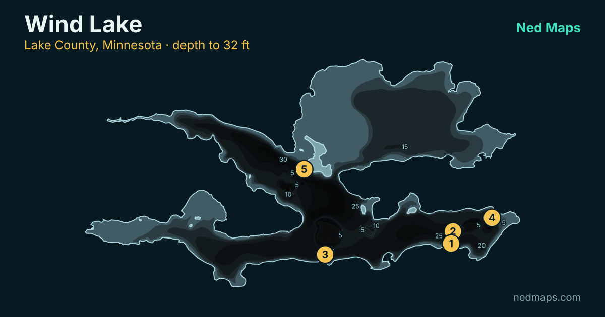
Within 30 miles
Nearby lakes
- Witness Lake · 41 ac · 1.2 mi
- Moose Lake · 1,301 ac · 1.8 mi
- Indiana Lake · 143 ac · 2.8 mi
- Flash Lake · 83 ac · 3.2 mi
- Wood Lake · 617 ac · 3.3 mi
- Manomin Lake · 409 ac · 3.4 mi
- Found Lake · 60 ac · 3.4 mi
- Good Lake · 175 ac · 3.7 mi
Quick answers
Frequently asked questions
How deep is Wind Lake?
Wind Lake reaches 32 ft at its deepest point; about 74% of the lake is littoral (15 ft or shallower).
How big is Wind Lake?
Wind Lake covers 926 acres with about 17.4 miles of shoreline.
How clear is the water in Wind Lake?
DNR Secchi readings on Wind Lake average 8 ft of visibility, middling clarity for a Minnesota lake.
What fish are in Wind Lake?
Minnesota DNR surveys (most recently 2011) record walleye, largemouth bass, smallmouth bass, northern pike, bluegill, yellow perch, rock bass.
Is Wind Lake stocked?
No stocking is on record for Wind Lake in the DNR's stocking database.
Does Wind Lake have a public access?
Yes. Wind Lake has 2 public access sites, including a US Forest Service access (Portage from Moose Lake).
How big do walleye get in Wind Lake?
The biggest walleye measured in recent DNR surveys taped 28".
When was Wind Lake last surveyed?
The Minnesota DNR last surveyed Wind Lake in 2011, the most recent of 2 surveys on record. A survey that old is a starting point, not a current reading.
Page updated .

Featured guide spot
Your guide service here
One featured guide per lake, with your photo, your writeup and a link straight to your booking page. Free through December 31, 2026.
Then $20 a month from January. Cancel any time.
The live map adds today's conditions and ranked spots for Wind Lake, plus a trip plan you can share:
Open Wind Lake on the live map → Fished it lately? Write a report