Minnesota · St. Louis County
Sabin Lake Fishing guide
Sabin Lake sits in St. Louis County, Minnesota, and covers 156 acres, reaching 465 ft at its deepest point. Average water clarity runs about 38.7 ft. The Minnesota DNR has surveyed the lake 8 times, most recently in 2023, with walleye, northern pike, bluegill and brook trout in the nets.
DNR survey data
Fish species
No recent survey rating.
No recent survey rating.
No recent survey rating.
Last recorded in the 2000 survey and not seen since.
Present and managed by the DNR. Standard survey gear does not count this species reliably.
Lake troutPresentPresent in recent DNR surveys.
Present in recent DNR surveys.
Lengths measured · 14 fish
Recent · 2023Lengths measured · 14 fish
2023Lengths measured · 50 fish
2017Lengths measured · 40 fish
2013Lengths measured · 43 fish
2005Rates come from standard DNR survey gear (gill nets, trap nets, electrofishing), judged against statewide benchmarks for the same gear, so the same number of fish per net can read differently for two species. Where the standard gear can't count a species reliably, only presence and size are listed. Typical is the middle fish of those measured. Open a row for the full length spread, survey by survey.
How to fish Sabin Lake through the year
Lake trout
- Spring
- Lake trout are spread over the deep breaks and humps, still using the whole water column. At 38.7 ft of clarity, fish them deeper and lighter than usual.
- Early summer
- Lake trout are dropping fast down the humps toward the cold layer as the lake stratifies.
- Summer
- Lake trout are deep on the humps and sharp breaks, below the thermocline in the coldest water they can find. On a lake that drops to 465 ft, check the deep edge of that structure too.
- Fall
- Lake trout are back up onto shallow rock, the humps and reefs where they spawn.
Rainbow trout
- Spring
- Rainbow are shallow on the breaks and around any inlet current, which is their spawning season. At 38.7 ft of clarity, fish them deeper and lighter than usual.
- Early summer
- Rainbow are dropping onto the breaks and points as the shallows warm past comfort.
- Summer
- Rainbow are deep on the breaks and humps, holding in the coldest oxygenated water. On a lake that drops to 465 ft, check the deep edge of that structure too.
- Fall
- Rainbow are spread back over the breaks and points as the surface cools into their range.
Season patterns for each species. Open the live map for today's wind, light and water temp.
Size history
Biggest fish by survey year
| Survey year | Lake trout | Rainbow trout | Walleye |
|---|---|---|---|
| 2023 | 22" | — | — |
| 2017 | 21" | — | — |
| 2013 | 20" | — | — |
| 2005 | 23" | 14" | — |
| 2000 | 22" | 12" | — |
| 1995 | 20" | — | — |
Longest fish measured by DNR survey crews in each year's nets. Survey gear samples the population, so the lake usually holds larger fish than any survey measured.
Suggested tackle
What to bring
Top presentations for this lake's structure and clarity:
Lake trout · Trolling
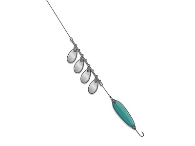
Trout Trolling (spoons/cowbells)
2–3in trolling spoon behind a small cowbell/dodger string
Lake trout · Jigs & bladed
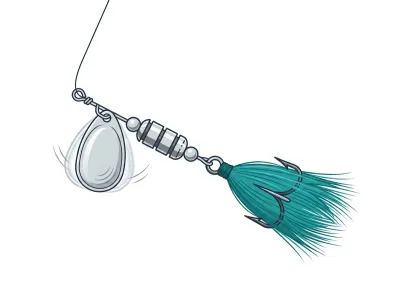
Inline Spinner (Mepps/Blue Fox)
#2–#4 in-line spinner
Rainbow trout · Trolling
Trout Trolling (spoons/cowbells)
2–3in trolling spoon behind a small cowbell/dodger string
Rainbow trout · Hardbaits
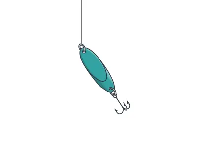
Casting Spoon (Kastmaster, stream/stocked trout)
1/8–1/4 oz compact casting spoon
Walleye · Live bait
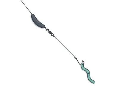
Live-Bait (Lindy) Rig + Leech/Crawler
jumbo leech or half a nightcrawler
Walleye · Trolling
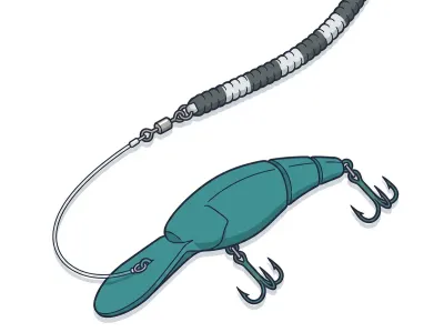
Leadcore Line + Crankbaits
4–5" mid-diving crankbait behind a long leadcore run
Full setups, including hooks, weights and line, are on the live map. As an Amazon Associate I earn from qualifying purchases.
DNR stocking records
Stocking history
| Year | Species | Stocked |
|---|---|---|
| 2025 | Rainbow Trout | 2,000 yearlings |
MN DNR · in their words
From the 2023 survey
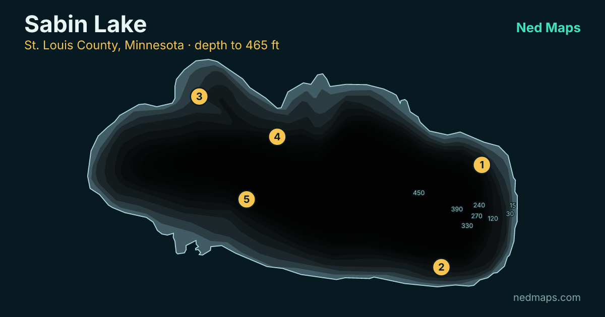
Sabin Lake (Embarrass Pit) is a 156-acre mine pit located between Biwabik and Aurora. There is a public access on the north shore of the lake with a steep concrete boat ramp. The lake has a maximum depth of 465 feet and extremely clear water.
On June 20, 2023, Embarrass Pit was thermally stratified with a surface temperature of 69 F and a temperature of 39 F at a depth of 100 feet. Oxygen levels were adequate for gamefish throughout the top 100 feet of the water column. Six gill nets were used to sample gamefish in this survey.
Read the full DNR narrative
Lake trout were sampled at a rate of 2.3 fish/net, which was slightly lower than the historical average for the lake. The average length of lake trout sampled was 15.0 inches, and the largest individual was 22.0 inches long. Lake trout were initially stocked into Embarrass Pit in 1985 and have not been stocked since, indicating that the lake supports a naturally reproducing population.
Other species sampled in gill nets included cisco, creek chub, and white sucker.
Zebra mussels are an aquatic invasive species that are present in Embarrass Pit. It is important for anglers and boaters to follow regulations when moving between lakes because these species can survive in or on boats, trailers, and equipment for some time. Be sure to drain all water from bait containers, live wells, bilge, and watercraft, dispose of any unused bait, and carefully inspect and remove any plants or animals attached to the watercraft, trailer, anchor, or other equipment before leaving the lake.
Narrative text from the Minnesota DNR lake survey.
Recent reports
Sabin Lake fishing reports
Recent reports on Sabin Lake from guides, tournaments and regular anglers. Anything posted in the last two weeks also bumps the matching spots on the live map, so you'll see a "matches a recent report" tag on them.
Public water access
Getting on the water
- Embarrass Mine Pit (trailer launch)
DNR bathymetry
Sabin Lake depth map
Within 30 miles
Nearby lakes
- Embarrass Lake · 463 ac · 1.5 mi
- Wynne Lake · 279 ac · 1.8 mi
- St James Pit · 124 ac · 2 mi
- Cedar Lake · 32 ac · 3 mi
- Sabin Lake · 312 ac · 3.3 mi
- Canton Pit · 161 ac · 3.3 mi
- Cedar Island Lake · 205 ac · 4 mi
- Whitewater Lake · 1,212 ac · 5.5 mi
Quick answers
Frequently asked questions
How deep is Sabin Lake?
Sabin Lake reaches 465 ft at its deepest point with a mean depth of 167 ft; about 8% of the lake is littoral (15 ft or shallower).
How big is Sabin Lake?
Sabin Lake covers 156 acres with about 2.3 miles of shoreline.
How clear is the water in Sabin Lake?
DNR Secchi readings on Sabin Lake average 38.7 ft of visibility, clear water for a Minnesota lake.
What fish are in Sabin Lake?
Minnesota DNR surveys (most recently 2023) record walleye, northern pike, bluegill, brook trout, rainbow trout, lake trout.
Is Sabin Lake stocked?
Yes. The DNR stocked rainbow trout in 2025.
Does Sabin Lake have a public access?
Yes. Sabin Lake has one public access site: Embarrass Mine Pit (trailer launch).
How big do lake trout get in Sabin Lake?
The biggest lake trout measured in recent DNR surveys taped 22"; the size-history table on this page tracks the biggest fish in each survey back to 1995.
When was Sabin Lake last surveyed?
The Minnesota DNR last surveyed Sabin Lake in 2023, the most recent of 8 surveys on record.
Page updated .

Featured guide spot
Your guide service here
One featured guide per lake, with your photo, your writeup and a link straight to your booking page. Free through December 31, 2026.
Then $20 a month from January. Cancel any time.
The live map adds today's conditions and ranked spots for Sabin Lake, plus a trip plan you can share:
Open Sabin Lake on the live map → Fished it lately? Write a report