Minnesota · Le Sueur County
Rays Lake Fishing guide
Rays Lake covers 169 acres in Le Sueur County, Minnesota, reaching 32 ft at its deepest point. Secchi readings average around 3.3 ft of visibility. The Minnesota DNR has surveyed the lake 10 times, most recently in 2021, with walleye, largemouth bass, northern pike and bluegill in the nets.
DNR survey data
Fish species
Northern pikePresent1per trap net22"Typical27"Biggest
Lengths measured · 10 fish
Recent · 2021Lengths measured · 10 fish
2021Lengths measured · 24 fish
2020Lengths measured · 25 fish
2014Lengths measured · 9 fish
2009Only 9 fish measured that year — too few to read as a shape.
BluegillFair numbers34.6per trap net5"Typical8"Biggest
Lengths measured · 267 fish
Recent · 2021Lengths measured · 267 fish
2021Lengths measured · 15 fish
2020Lengths measured · 232 fish
2014Lengths measured · 774 fish
2009CrappieOne of the best around38.4per trap net6"Typical11"Biggest
Lengths measured · 346 fish
Recent · 2021Lengths measured · 346 fish
2021Lengths measured · 140 fish
2020Lengths measured · 36 fish
2014Lengths measured · 332 fish
2009No recent survey rating.
Rates come from standard DNR survey gear (gill nets, trap nets, electrofishing), judged against statewide benchmarks for the same gear, so the same number of fish per net can read differently for two species. Where the standard gear can't count a species reliably, only presence and size are listed. Typical is the middle fish of those measured. Open a row for the full length spread, survey by survey.
How to fish Rays Lake through the year
Walleye
- Spring
- Walleye are shallow, on and just off the spawning flats and the first green weeds. In 3.3 ft of visibility, they sit shallower than you think.
- Early summer
- Walleye are setting up on the outside weed edge, points and shallow structure.
- Summer
- Walleye are working the weed edge, points and any wind-blown structure. With 82% of this lake 15 ft or shallower, the weed edge is the main event.
- Fall
- Walleye are packing onto the sharpest breaks and points as the water cools, in big schools with short windows.
Largemouth bass
- Spring
- Largemouth are moving up into the warming bays and flats, staging around wood, docks and new weeds to spawn. In 3.3 ft of visibility, they sit shallower than you think.
- Early summer
- Largemouth are on the shallow spawning flats and protected bays, where beds go on firm bottom next to isolated cover.
- Summer
- Largemouth are in and along the weeds: cabbage and milfoil edges, matted cover and shade. With 82% of this lake 15 ft or shallower, the weed edge is the main event.
- Fall
- Largemouth are chasing bait back onto the flats and into the remaining green weeds, feeding hard and shallow before the freeze.
Season patterns for each species. Open the live map for today's wind, light and water temp.
Size history
Biggest fish by survey year
| Survey year | Walleye | Largemouth bass | Northern pike |
|---|---|---|---|
| 2021 | 23" | 14" | 27" |
| 2020 | 19" | 12" | 27" |
| 2014 | 24" | 14" | 28" |
| 2009 | 21" | 14" | 31" |
| 2003 | 27" | 7" | 27" |
| 1995 | 22" | 9" | 25" |
Longest fish measured by DNR survey crews in each year's nets. Survey gear samples the population, so the lake usually holds larger fish than any survey measured.
Suggested tackle
What to bring
Top presentations for this lake's structure and clarity:
Walleye · Live bait
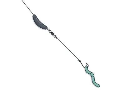
Live-Bait (Lindy) Rig + Leech/Crawler
jumbo leech or half a nightcrawler
Walleye · Trolling
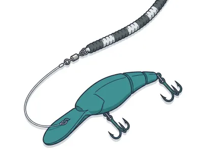
Leadcore Line + Crankbaits
4–5" mid-diving crankbait behind a long leadcore run
Largemouth bass · Soft plastics
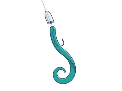
Texas-Rigged Worm
7" ribbon-tail or straight-tail plastic worm
Largemouth bass · Soft plastics
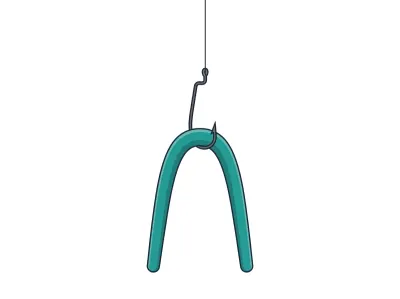
Wacky-Rigged Stickworm
5" stickworm
Northern pike · Soft plastics
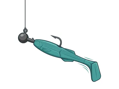
Paddletail Swimbait on Jighead
4–5" paddletail swimbait on a ball-head swimbait jighead
Northern pike · Jigs & bladed
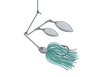
Spinnerbait
3/8–1/2 oz safety-pin spinnerbait with tandem willow-leaf blades
Full setups, including hooks, weights and line, are on the live map. As an Amazon Associate I earn from qualifying purchases.
MN DNR · in their words
From the 2021 survey
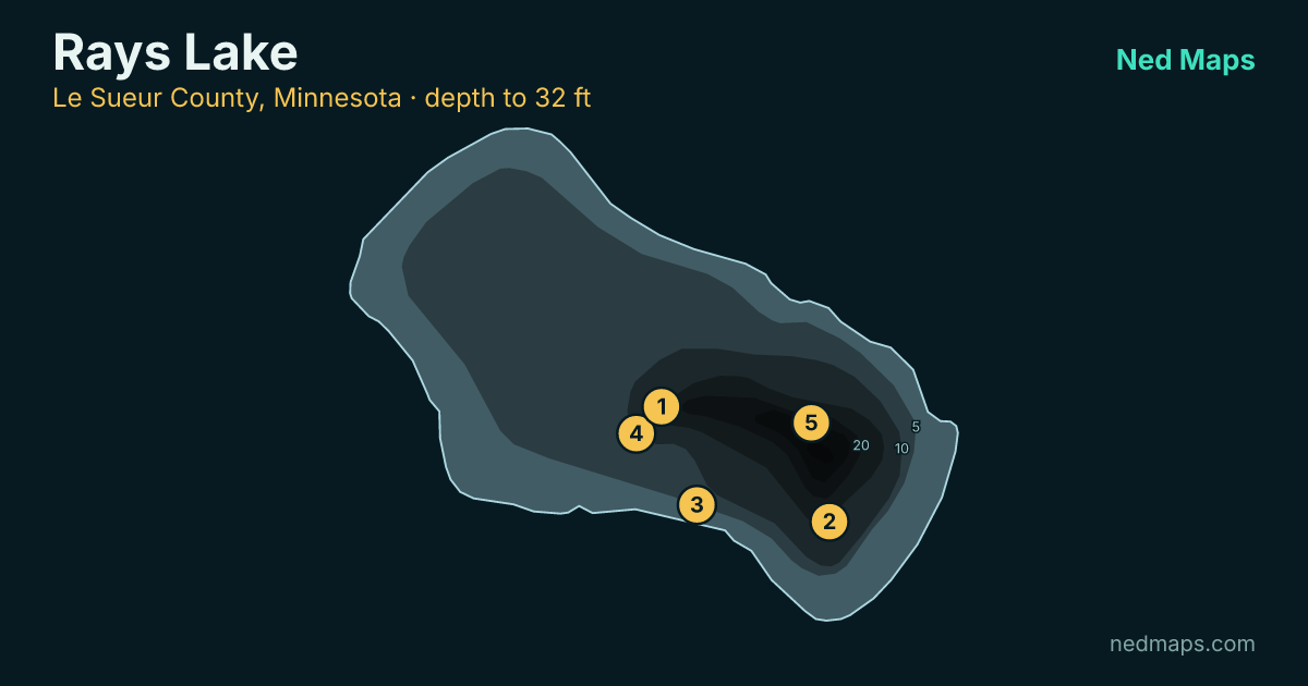
Rays (Charles) Lake is a 156.3-acre lake located in Le Sueur County north of the town of Elysian. A public access is located on the south side of the lake off 1st Street North, which goes north from Elysian. Rays Lake has a maximum depth of 32.0 feet. Eurasian watermilfoil is present in Rays Lake. Boaters should be sure to remove all aquatic vegetation from boats, trailers, and equipment and drain all water from livewell, transoms, and bilges when leaving the lake to prevent the spread of Eurasian watermilfoil to other lakes. Rays Lake is primarily managed for Bluegill, Black Crappie, and Largemouth Bass and secondarily managed for Northern Pike. Fish are only stocked in Rays Lake in the event of a winterkill. The last stocking event on record took place in 1980.
Gill nets and boat electrofishing were completed during the regularly scheduled survey in 2020 but trap nets were postponed until 2021 due to COVID protocols. The 2021 targeted survey was completed the week of 26 July 2021 using 9 trap nets. A targeted survey is generally used for sampling a specific kind of fish or time of year (i.e., spawning season, fall season, etc.) unlike a standard survey which samples a wider range of fish species during the summer months using standard methods (i.e., standard time of year, set sampling stations, taking water clarity readings and oxygen/temperature profiles, etc.) and gears (i.e., lake survey gillnets, trap nets, and spring electrofishing for Largemouth Bass). Results from this targeted survey should not be compared to results from standard surveys.
Read the full DNR narrative
A total of 311 Bluegills were sampled for a catch rate of 34.6/net, indicating moderate to high numbers were present. Bluegills ranged from 3.2 to 8.2 inches with an average of 5.5 inches. Size structure was poor with few fish over 7 inches.
A total of 346 Black Crappie were sampled with trap nets for a catch rate of 38.4/net. Black Crappie ranged from 0.75 to 11.3 inches and averaged 7.0 inches. Black Crappie size structure was poor but fish over 10 inches were sampled.
Other game fish sampled in low numbers in 2021 include Walleye, Northern Pike, and Yellow Perch.
Shoreline property owners also play an important role in the overall health of an aquatic ecosystem, including the fish population. Natural shorelines, including vegetation, woody debris, and bottom substrates, provide valuable habitat for fish and wildlife, help maintain water quality, and reduce bank erosion. Cattails and bulrushes are particularly beneficial for fish spawning, rearing, and feeding. By leaving natural shorelines unaltered or restoring them to natural conditions, shoreline property owners are doing their part to maintain or improve a healthy ecosystem in the lake and protect the resource for future generations.
- Tyler Fellows, Fisheries Specialist
Narrative text from the Minnesota DNR lake survey.
Recent reports
Rays Lake fishing reports
Recent reports on Rays Lake from guides, tournaments and regular anglers. Anything posted in the last two weeks also bumps the matching spots on the live map, so you'll see a "matches a recent report" tag on them.
Public water access
Getting on the water
- Rays Lake (trailer launch)
- Rays Lake Fishing Pier (fishing pier)
DNR bathymetry
Rays Lake depth map
Within 30 miles
Nearby lakes
- Fish Lake · 77 ac · 1.3 mi
- Frances Lake · 927 ac · 1.3 mi
- Steele Lake · 76 ac · 2.1 mi
- Lily Lake · 114 ac · 2.4 mi
- Elysian (Main Lake) · 2,215 ac · 3 mi
- Roemhildts Lake · 74 ac · 3.6 mi
- Reeds Lake · 195 ac · 3.6 mi
- Tetonka Lake · 1,358 ac · 3.8 mi
Quick answers
Frequently asked questions
How deep is Rays Lake?
Rays Lake reaches 32 ft at its deepest point; about 82% of the lake is littoral (15 ft or shallower).
How big is Rays Lake?
Rays Lake covers 169 acres with about 2.2 miles of shoreline.
How clear is the water in Rays Lake?
DNR Secchi readings on Rays Lake average 3.3 ft of visibility, on the stained end for a Minnesota lake.
What fish are in Rays Lake?
Minnesota DNR surveys (most recently 2021) record walleye, largemouth bass, northern pike, bluegill, crappie, yellow perch, white bass.
Is Rays Lake stocked?
No stocking is on record for Rays Lake in the DNR's stocking database.
Does Rays Lake have a public access?
Yes. Rays Lake has 2 public access sites, including Rays Lake (trailer launch).
How big do walleye get in Rays Lake?
The biggest walleye measured in recent DNR surveys taped 23"; the size-history table on this page tracks the biggest fish in each survey back to 1995.
When was Rays Lake last surveyed?
The Minnesota DNR last surveyed Rays Lake in 2021, the most recent of 10 surveys on record.
Page updated .

Featured guide spot
Your guide service here
One featured guide per lake, with your photo, your writeup and a link straight to your booking page. Free through December 31, 2026.
Then $20 a month from January. Cancel any time.
The live map adds today's conditions and ranked spots for Rays Lake, plus a trip plan you can share:
Open Rays Lake on the live map → Fished it lately? Write a report