Minnesota · Otter Tail County
Little Pine Lake Fishing guide
Little Pine Lake sits in Otter Tail County, Minnesota, and covers 2,080 acres, reaching 63 ft at its deepest point. Average water clarity runs about 9 ft. The Minnesota DNR has surveyed the lake 14 times, most recently in 2024, with walleye, largemouth bass, smallmouth bass and northern pike in the nets.
DNR survey data
Fish species
WalleyeExcellent numbers10.2per gill net14"Typical28"Biggest
Lengths measured · 215 fish
Recent · 2021 + 2023Lengths measured · 90 fish
2023Lengths measured · 125 fish
2021Lengths measured · 203 fish
2017Lengths measured · 267 fish
2011No recent survey rating.
Northern pikeFair numbers9.3per gill net22"Typical37"Biggest
Lengths measured · 194 fish
Recent · 2021 + 2023Lengths measured · 77 fish
2023Lengths measured · 117 fish
2021Lengths measured · 58 fish
2017Lengths measured · 176 fish
2011BluegillPresent0.3per gill net2"Typical10"Biggest
Lengths measured · 36 fish
Recent · 2023 + 2024Lengths measured · 33 fish
2024Lengths measured · 3 fish
2023Only 3 fish measured that year — too few to read as a shape.
Lengths measured · 17 fish
2017Lengths measured · 27 fish
2011CrappieJust a few0.9per trap net4"Typical5"Biggest
Lengths measured · 12 fish
Recent · 2017Lengths measured · 12 fish
2017Lengths measured · 4 fish
2011Only 4 fish measured that year — too few to read as a shape.
Lengths measured · 3 fish
2008Only 3 fish measured that year — too few to read as a shape.
Lengths measured · 3 fish
2005Only 3 fish measured that year — too few to read as a shape.
Yellow perchExcellent numbers25.6per gill net6"Typical10"Biggest
Lengths measured · 537 fish
Recent · 2021 + 2023Lengths measured · 11 fish
2023Lengths measured · 526 fish
2021Lengths measured · 548 fish
2017Lengths measured · 321 fish
2011Present in recent DNR surveys.
Rates come from standard DNR survey gear (gill nets, trap nets, electrofishing), judged against statewide benchmarks for the same gear, so the same number of fish per net can read differently for two species. Where the standard gear can't count a species reliably, only presence and size are listed. Typical is the middle fish of those measured. Open a row for the full length spread, survey by survey.
How to fish Little Pine Lake through the year
Walleye
- Spring
- Walleye are shallow, on and just off the spawning flats and the first green weeds.
- Early summer
- Walleye are setting up on the outside weed edge, points and shallow structure.
- Summer
- Walleye are working the weed edge, points and any wind-blown structure. On a lake that drops to 63 ft, check the deep edge of that structure too.
- Fall
- Walleye are packing onto the sharpest breaks and points as the water cools, in big schools with short windows.
Northern pike
- Spring
- Pike are in the shallow bays and along new weed growth.
- Early summer
- Pike are on the outside weed edge and points.
- Summer
- Pike are on the deep weed edge and points near the coolest water they can find. On a lake that drops to 63 ft, check the deep edge of that structure too.
- Fall
- Pike are on the last green weeds and the breaks beside them, feeding heavily as the water drops.
Season patterns for each species. Open the live map for today's wind, light and water temp.
Size history
Biggest fish by survey year
| Survey year | Walleye | Northern pike | Lake sturgeon |
|---|---|---|---|
| 2023 | 21" | 35" | 39" |
| 2021 | 28" | 37" | — |
| 2017 | 27" | 33" | — |
| 2011 | 25" | 33" | — |
| 2008 | 26" | 33" | — |
| 2005 | 25" | 36" | — |
| 2002 | 25" | 31" | — |
| 1999 | 28" | 41" | — |
Longest fish measured by DNR survey crews in each year's nets. Survey gear samples the population, so the lake usually holds larger fish than any survey measured.
Suggested tackle
What to bring
Top presentations for this lake's structure and clarity:
Walleye · Live bait
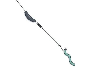
Live-Bait (Lindy) Rig + Leech/Crawler
jumbo leech or half a nightcrawler
Walleye · Trolling
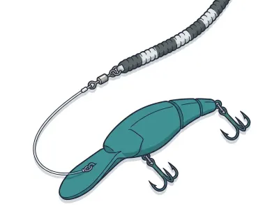
Leadcore Line + Crankbaits
4–5" mid-diving crankbait behind a long leadcore run
Northern pike · Soft plastics
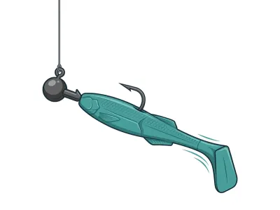
Paddletail Swimbait on Jighead
4–5" paddletail swimbait on a ball-head swimbait jighead
Northern pike · Muskie & pike
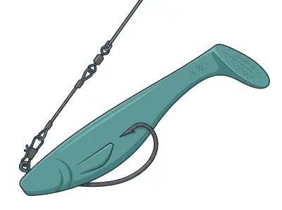
Soft Rubber (Bull Dawg / Medusa)
10" soft rubber body bait
Lake sturgeon · Live bait
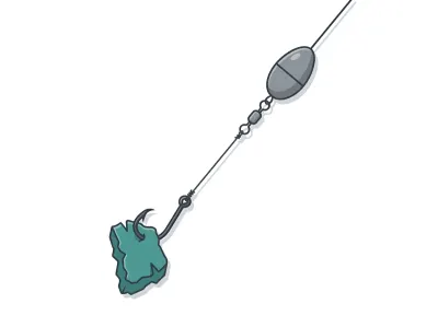
Sliding-Sinker Catfish Rig
cut sucker or shad
Full setups, including hooks, weights and line, are on the live map. As an Amazon Associate I earn from qualifying purchases.
MN DNR · in their words
From the 2024 survey
Little Pine Lake is a 1,969-acre mesotrophic (moderately fertile) lake located in northeastern Otter Tail County approximately two miles north of Perham, MN. Little Pine Lake is a part of the Otter Tail River Watershed and is connected to Big Pine Lake via the Otter Tail River. The Otter Tail River inlet is located along the west shoreline of the lake while the outlet is located along the southeast shoreline. The Otter Tail River is navigable by boat upstream of Little Pine Lake. The immediate watershed is composed primarily of agricultural land interspersed with hardwood woodlots; however, there has recently been an increase in residential development. The maximum depth of Little Pine Lake is 63 feet; however, thirty-five percent of the lake is less than 15 feet in depth. Previous secchi disk readings ranged from 5.5 to 18.5 feet.
The shoreline of Little Pine Lake has been extensively developed. Homes, cottages, and resorts compose the majority of the development. A DNR owned concrete public access is located off of County Road 8 along the southeast shoreline of the lake. A city owned (Perham) concrete public access is located off of County Road 51 along the west shoreline of the lake. Remnant stands of hardstem bulrush and common cattail are located in the area near the Otter Tail River inlet. Emergent aquatic plants such as bulrush and cattail provide valuable fish and wildlife habitat, and are critical for maintaining good water quality. Emergent plants provide spawning areas for fish such as Northern Pike, Largemouth Bass, and panfish. They also serve as important nursery areas for all species of fish. Because of their ecological value, emergent plants may not be removed without a DNR permit. To maintain the excellent water quality and angling that this lake has to offer, it is imperative to preserve the quality of the aquatic habitat.
Read the full DNR narrative
Little Pine Lake is a popular angling lake during both the open water and ice fishing seasons. The lake has a reputation as one of the premier Walleye fishing lakes in Otter Tail County. Northern Pike are also abundant and have an excellent size distribution as well. The prolificacy of these species can be attributed to the abundance of suitable spawning habitat that is available.
A reduced daily bag limit regulation for sunfish (10 per day) and crappie (5 per day) was implemented in 2025. The objective of the regulation is to maintain or improve the abundances and size structure of the Bluegill and Black Crappie populations.
A special spring trap netting survey was conducted to collect baseline data on the Bluegill population, which will be used for regulation evaluation purposes in future surveys. The Bluegill population is low-density and has a quality size structure. Age data indicate that Bluegill reproduction is likely inconsistent. Twenty-one percent of the Bluegill sample was 7.0 inches or greater in length, while 18% was 8.0 inches or greater in length. Bluegills attain an average length of 8.3 inches at seven years of age.
Anglers can maintain the quality of angling in Little Pine Lake by practicing selective harvest. Selective harvest encourages the release of medium to large-size fish while allowing the harvest of the more abundant smaller fish for table fare. Releasing the medium to large fish will ensure that the lake will have enough spawning age fish on an annual basis and will provide anglers with more opportunities to catch large fish in the future.
Little Pine Lake was listed as infested with zebra mussels in 2020. Aquatic invasive species are threatening Minnesota waters. The non-native fish species can potentially harm water quality, water recreation, aquatic habitat, native species, and fish populations. Anglers can help prevent the introduction and spread of invasive species by following watercraft transportation laws.
Narrative text from the Minnesota DNR lake survey.
Recent reports
Little Pine Lake fishing reports
Recent reports on Little Pine Lake from guides, tournaments and regular anglers. Anything posted in the last two weeks also bumps the matching spots on the live map, so you'll see a "matches a recent report" tag on them.
Public water access
Getting on the water
- Little Pine Lake (E) (trailer launch)
- Little Pine Lake (SW) (trailer launch)
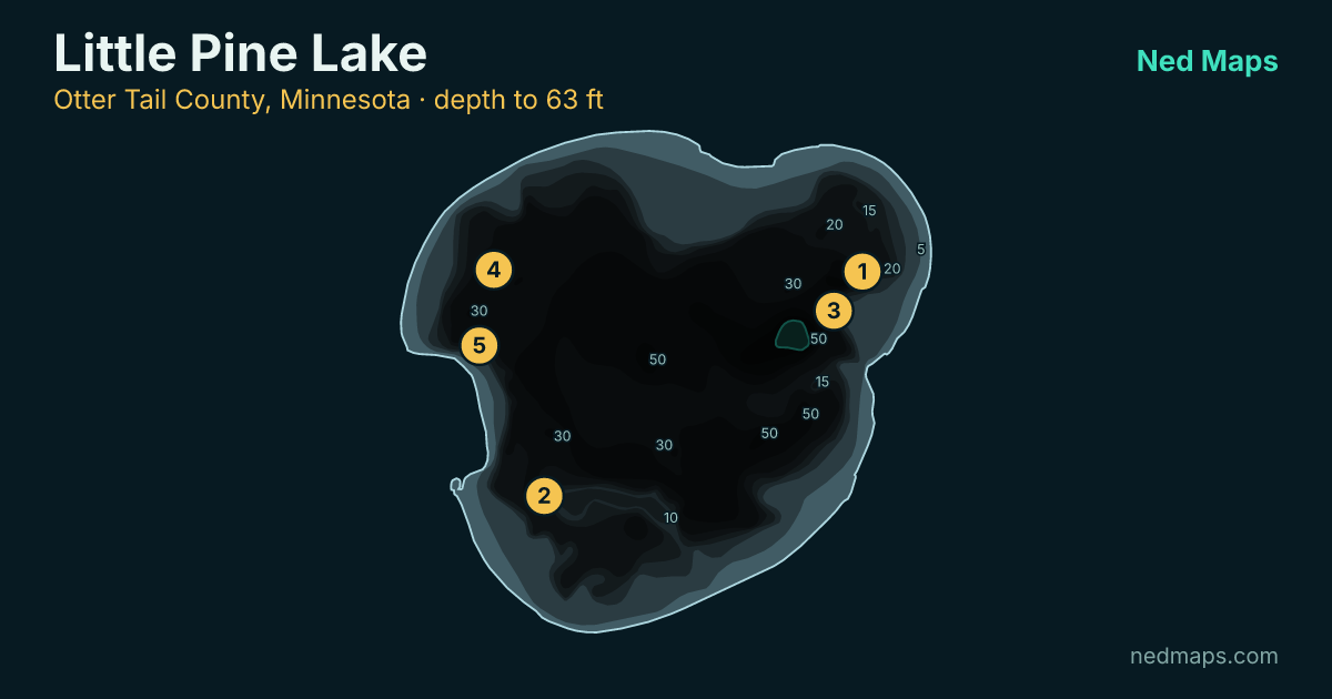
DNR bathymetry
Little Pine Lake depth map
Within 30 miles
Nearby lakes
- Big Pine Lake · 4,728 ac · 3.6 mi
- Devils Lake · 355 ac · 4.6 mi
- Silver Lake · 239 ac · 6.6 mi
- Murphy Lake · 317 ac · 7 mi
- Paul Lake · 347 ac · 7.2 mi
- Little McDonald Lake · 1,316 ac · 7.6 mi
- Jim Lake · 101 ac · 8 mi
- Bear Lake · 198 ac · 8.2 mi
Quick answers
Frequently asked questions
How deep is Little Pine Lake?
Little Pine Lake reaches 63 ft at its deepest point; about 34% of the lake is littoral (15 ft or shallower).
How big is Little Pine Lake?
Little Pine Lake covers 2,080 acres with about 7.3 miles of shoreline.
How clear is the water in Little Pine Lake?
DNR Secchi readings on Little Pine Lake average 9 ft of visibility, middling clarity for a Minnesota lake.
What fish are in Little Pine Lake?
Minnesota DNR surveys (most recently 2024) record walleye, largemouth bass, smallmouth bass, northern pike, bluegill, crappie, yellow perch, lake sturgeon, rock bass.
Is Little Pine Lake stocked?
No stocking is on record for Little Pine Lake in the DNR's stocking database.
Does Little Pine Lake have a public access?
Yes. Little Pine Lake has 2 public access sites, including Little Pine Lake (E) (trailer launch).
How big do walleye get in Little Pine Lake?
The biggest walleye measured in recent DNR surveys taped 28"; the size-history table on this page tracks the biggest fish in each survey back to 1999.
When was Little Pine Lake last surveyed?
The Minnesota DNR last surveyed Little Pine Lake in 2024, the most recent of 14 surveys on record.
Page updated .

Featured guide spot
Your guide service here
One featured guide per lake, with your photo, your writeup and a link straight to your booking page. Free through December 31, 2026.
Then $20 a month from January. Cancel any time.
The live map adds today's conditions and ranked spots for Little Pine Lake, plus a trip plan you can share:
Open Little Pine Lake on the live map → Fished it lately? Write a report