Minnesota · Cook County
Brule Lake Fishing guide
Brule Lake covers 4,327 acres in Cook County, Minnesota, reaching 78 ft at its deepest point. Average water clarity runs about 16.2 ft. The Minnesota DNR has surveyed the lake 6 times, most recently in 2023, with walleye, smallmouth bass, northern pike and yellow perch in the nets.
DNR survey data
Fish species
WalleyeGood numbers5.3per gill net16"Typical24"Biggest
Lengths measured · 75 fish
Recent · 2019Lengths measured · 75 fish
2019Lengths measured · 55 fish
2009Lengths measured · 55 fish
1996Smallmouth bassPresent (last recorded 2019)0.9per gill net2"Typical18"Biggest
Lengths measured · 36 fish
Recent · 2019Lengths measured · 36 fish
2019Lengths measured · 28 fish
2009Lengths measured · 3 fish
1996Only 3 fish measured that year — too few to read as a shape.
Yellow perchJust a few0.1per gill net3"Typical6"Biggest
Lengths measured · 10 fish
Recent · 2019Lengths measured · 10 fish
2019Lengths measured · 203 fish
2009Rates come from standard DNR survey gear (gill nets, trap nets, electrofishing), judged against statewide benchmarks for the same gear, so the same number of fish per net can read differently for two species. Where the standard gear can't count a species reliably, only presence and size are listed. Typical is the middle fish of those measured. Open a row for the full length spread, survey by survey.
How to fish Brule Lake through the year
Walleye
- Spring
- Walleye are shallow, on and just off the spawning flats and the first green weeds. At 16.2 ft of clarity, fish them deeper and lighter than usual.
- Early summer
- Walleye are setting up on the outside weed edge, points and shallow structure.
- Summer
- Walleye are working the weed edge, points and any wind-blown structure. On a lake that drops to 78 ft, check the deep edge of that structure too.
- Fall
- Walleye are packing onto the sharpest breaks and points as the water cools, in big schools with short windows.
Smallmouth bass
- Spring
- Smallmouth are on shallow rock, gravel and sand where they spawn. At 16.2 ft of clarity, fish them deeper and lighter than usual.
- Early summer
- Smallmouth are post-spawn on rock points, gravel bars and the adjacent breaks.
- Summer
- Smallmouth are on rock humps, points and hard-bottom breaks. On a lake that drops to 78 ft, check the deep edge of that structure too.
- Fall
- Smallmouth are bunched tight on deep rock, so find one and you have found the school.
Season patterns for each species. Open the live map for today's wind, light and water temp.
Size history
Biggest fish by survey year
| Survey year | Walleye | Smallmouth bass | Northern pike |
|---|---|---|---|
| 2019 | 24" | 18" | 24" |
| 2009 | 20" | 17" | 22" |
| 1996 | 21" | 16" | 27" |
Longest fish measured by DNR survey crews in each year's nets. Survey gear samples the population, so the lake usually holds larger fish than any survey measured.
Suggested tackle
What to bring
Top presentations for this lake's structure and clarity:
Walleye · Live bait
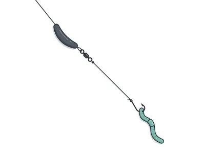
Live-Bait (Lindy) Rig + Leech/Crawler
jumbo leech or half a nightcrawler
Walleye · Trolling
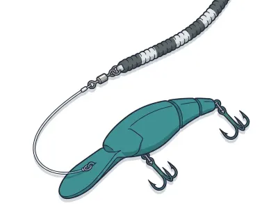
Leadcore Line + Crankbaits
4–5" mid-diving crankbait behind a long leadcore run
Smallmouth bass · Soft plastics
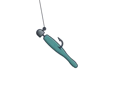
Ned Rig
2.75" finesse stickbait or craw-style Ned bait
Smallmouth bass · Soft plastics
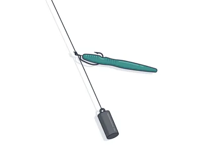
Drop Shot (Finesse Plastic)
4" finesse worm or 3" minnow-profile plastic
Northern pike · Soft plastics
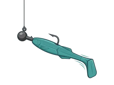
Paddletail Swimbait on Jighead
4–5" paddletail swimbait on a ball-head swimbait jighead
Northern pike · Jigs & bladed
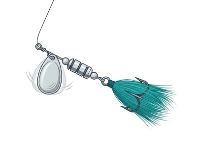
Inline Spinner (Mepps/Blue Fox)
#2–#4 in-line spinner
Full setups, including hooks, weights and line, are on the live map. As an Amazon Associate I earn from qualifying purchases.
MN DNR · in their words
From the 2023 survey
A temperature-dissolved oxygen profile was collected in the deepest basin on Brule Lake on August 24th, 2023, to evaluate the amount of cold, oxygenated water (i.e., oxythermal habitat) available to Cisco, also known as Tullibee. Based on the profile, the top of the thermocline (i.e., the location in the water column with the sharpest transition from warm to cold water) occurred at approximately 23 feet. Dissolved oxygen decreased to below 3.0 mg/L at 60.4 feet, which was below the thermocline, at the time of sampling. The temperature at which dissolved oxygen decreased to below 3.0 mg/L (i.e., TDO3, a single variable to characterize oxythermal habitat) was 8.8°C (47.8°F).
TDO3 values cooler than 21.5°C indicate that oxythermal conditions are favorable for Cisco. Dissolved oxygen concentrations below the thermocline indicate that suitable oxythermal habitat for Cisco was available across a range of depths at the time of sampling during the summer of 2023. Data collected in 1977 and 1983 also indicated suitable oxythermal habitat. When adequate oxythermal habitat is available, Cisco are not squeezed into unfavorable, warmer water conditions and therefore do not experience higher levels of stress.
Narrative text from the Minnesota DNR lake survey.
Recent reports
Brule Lake fishing reports
Recent reports on Brule Lake from guides, tournaments and regular anglers. Anything posted in the last two weeks also bumps the matching spots on the live map, so you'll see a "matches a recent report" tag on them.
Public water access
Getting on the water
- Brule Lake (carry-in)
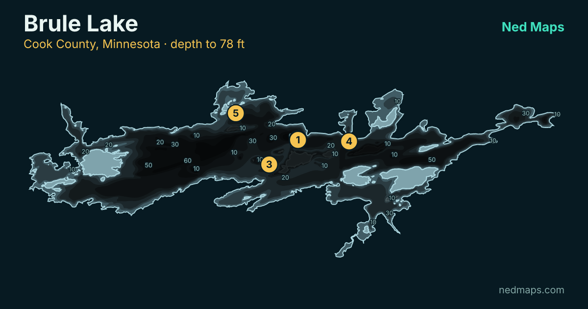
DNR bathymetry
Brule Lake depth map
Within 30 miles
Nearby lakes
- Juno Lake · 216 ac · 2.1 mi
- Homer Lake · 434 ac · 2.6 mi
- Star Lake · 107 ac · 2.7 mi
- Davis Lake · 323 ac · 3.4 mi
- Wench Lake · 24 ac · 3.5 mi
- East Pipe Lake · 105 ac · 3.7 mi
- Cash Lake · 71 ac · 4.4 mi
- Tomash Lake · 95 ac · 4.4 mi
Quick answers
Frequently asked questions
How deep is Brule Lake?
Brule Lake reaches 78 ft at its deepest point with a mean depth of 35 ft; about 33% of the lake is littoral (15 ft or shallower).
How big is Brule Lake?
Brule Lake covers 4,327 acres with about 63.1 miles of shoreline.
How clear is the water in Brule Lake?
DNR Secchi readings on Brule Lake average 16.2 ft of visibility, clear water for a Minnesota lake.
What fish are in Brule Lake?
Minnesota DNR surveys (most recently 2023) record walleye, smallmouth bass, northern pike, yellow perch.
Is Brule Lake stocked?
No stocking is on record for Brule Lake in the DNR's stocking database.
Does Brule Lake have a public access?
Yes. Brule Lake has one public access site: Brule Lake (carry-in).
How big do walleye get in Brule Lake?
The biggest walleye measured in recent DNR surveys taped 24"; the size-history table on this page tracks the biggest fish in each survey back to 1996.
When was Brule Lake last surveyed?
The Minnesota DNR last surveyed Brule Lake in 2023, the most recent of 6 surveys on record.
Page updated .

Featured guide spot
Your guide service here
One featured guide per lake, with your photo, your writeup and a link straight to your booking page. Free through December 31, 2026.
Then $20 a month from January. Cancel any time.
The live map adds today's conditions and ranked spots for Brule Lake, plus a trip plan you can share:
Open Brule Lake on the live map → Fished it lately? Write a report